History of the village Viničné
The first written mention of the village is on the deed of gift of Andrew II. Tomáš, Nitra county, from 1208. It mentions a neighboring village on the eastern side of Pezinok called Villa Suslan, located on the territory of today's Viničný. Another mention is from 1256, when the description of the borders of Pezinka mentions a neighboring village on the south side of Šenkvíc under the name Susulan. Jobagioni - administrators of Bratislava Castle lived in it. The name of the municipality of Suslan or Susulan is given in documents with a Latin text. Historians differ on the translation of this name. Historian Ján Stanislav read this name as Šušlany - from the word šušlať. Peter Ratkaš read the name as Šušol. According to the historian Branislav Varsik, the word Suslan should be read as Žúžoľ or Žužľany, which according to the historical dictionary of Slovak means "charcoal" - black. Branislav Varsik believed that the name originated from the black earth around the village. Historian Vincent Sedlák interpreted the name of the village as "coal". He deduced this from the fact that the inhabitants of the nearby forest produced charcoal.
At the beginning of the 13th century, all the villages and settlements in the vicinity of Pezinok, including the present-day Viničná, were economically developed and independent villages. Perhaps that is why and perhaps also because of the favorable natural conditions, this area was inhabited by the German population. During this period, our village is mentioned in historical records under the name Schweisbach, as well as Swanspoch. When Emperor Charles V sent his troops to fight the Turks in the 16th century, Spanish warriors settled for some time in the area between Bratislava, Senec and Trnava. During their stay, many villages were destroyed and burned. Among them is our village. In the records of the Bratislava capital from 1553, it is written about a village called Swanczpoch that the Spaniards burned "15 port (combustos) per Hispanos" here. In the second half of the 16th century, a new population began to settle here, which, according to a historical record from 1773, spoke mostly Slovak. Proof of this are the names of land and vineyards: Repnice, Kopanice, Kúty, Podomné, Vŕbske, Spodky, Meadow parts, Hoštáky, Privilege, Čierna zem, etc. Some of the original names have survived to this day.
On maps and documents from the 19th century from the period of the Austro-Hungarian monarchy, the village is mentioned under the Hungarian name Hattyú patak (Swan Stream). In the period before the First World War, the name Labudová was also used.
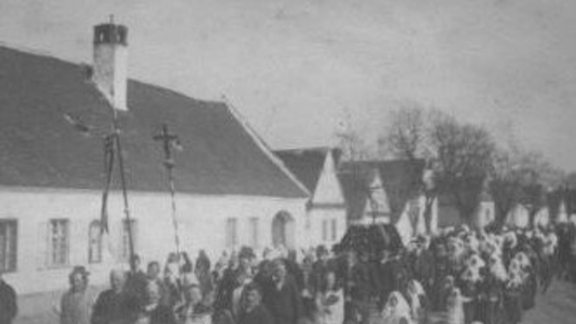
After the First World War, the village was "divided" into three parts, each with its own local name. Part of the village from the church towards Pezinok was called Domovina. The central part of the village, from the church to the Notary's Office (later the Local National Committee, now the Municipal Office), is mentioned in historical records as the Village. The third part of the village, from the Notary's Office towards Senec, was called the Balkans.
These names are still used in the village today. View from the church tower to today's Kozia, Nová and Orechová streets View from the church tower to today's Športová street, in the background to see the Evangelical cemetery and pond The current name of the village Viničné was created in 1948. The name was derived from the vineyard, which is grown in this area. from the distant past.

 Slovak
 Czech
Czech
 Hungarian
 German
, Kostol svätých Filipa a Jakuba; celkový pohľad")