The larger part of the area (upper or upper field - dzíle) is located in the foreground of the Trnava Uplands and its marginal part of the Trnava Loess Plate. The lower part of the area, also called Shur, belongs geomorphologically to the Small Danube Province. Čatajský district in the past, and still today, borders the municipalities of Veľký Grob, Reca, Boldog, Igram, Cífer, Pác and Slovenská Nová Ves.
From the history of the village
"The present also includes memories of the past, they are part of it."
The village of Čataj is exceptional within its region not only in terms of ethnography, but also religiosity and mentality. This manifested itself especially in the individual stages of historical development. Since Čataj and Veľký Grob form an ethnographic mini-island in the wider and narrower region, they also form an exceptionality in the history of Slovakia and the Slovak nation.
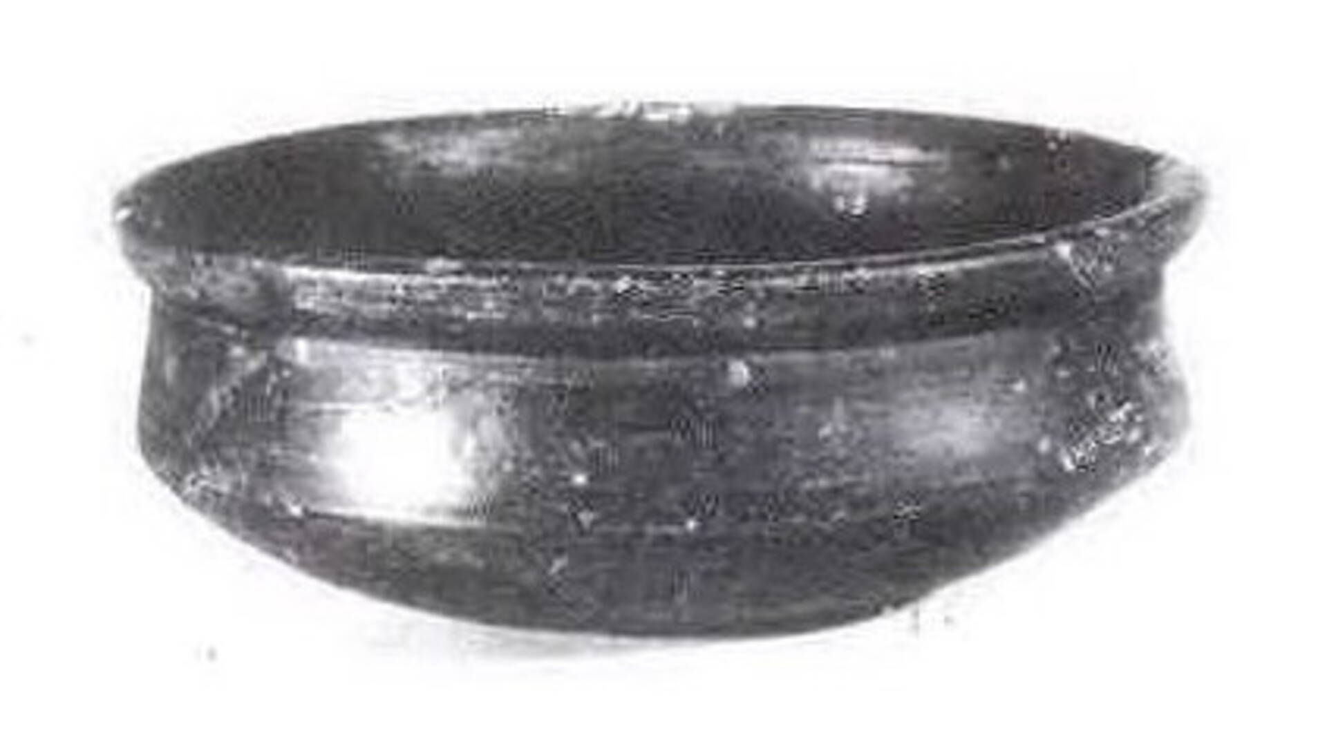
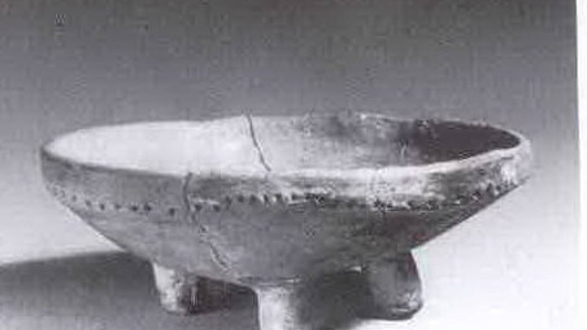
For the first time, Čataj is mentioned in a false deed of King Bel IV. from 1244 as a villa (property, mayor) Chatey. However, we do not know much about its origin and meaning, and the origin of the name is unclear. However, the year 1244 is not the year of the foundation or establishment of the village. This was already here as a settlement or property phenomenon. In the 6th millennium BC, agriculture began to develop in our territory, when peasant tribes began to penetrate here from the south. The oldest farmers settled in places called "Vyše Kandy" and "Za zahradady". The bearers of this peasant civilization are generally referred to as the people of culture with linear pottery. Research shows that farmers built the first large wheeled houses in Chatai. Inside, there were hearths around which individual families were probably concentrated. These people made work tools from stone and animal bones. They raised cattle, sheep, pigs, chickens, and dogs kept their houses.
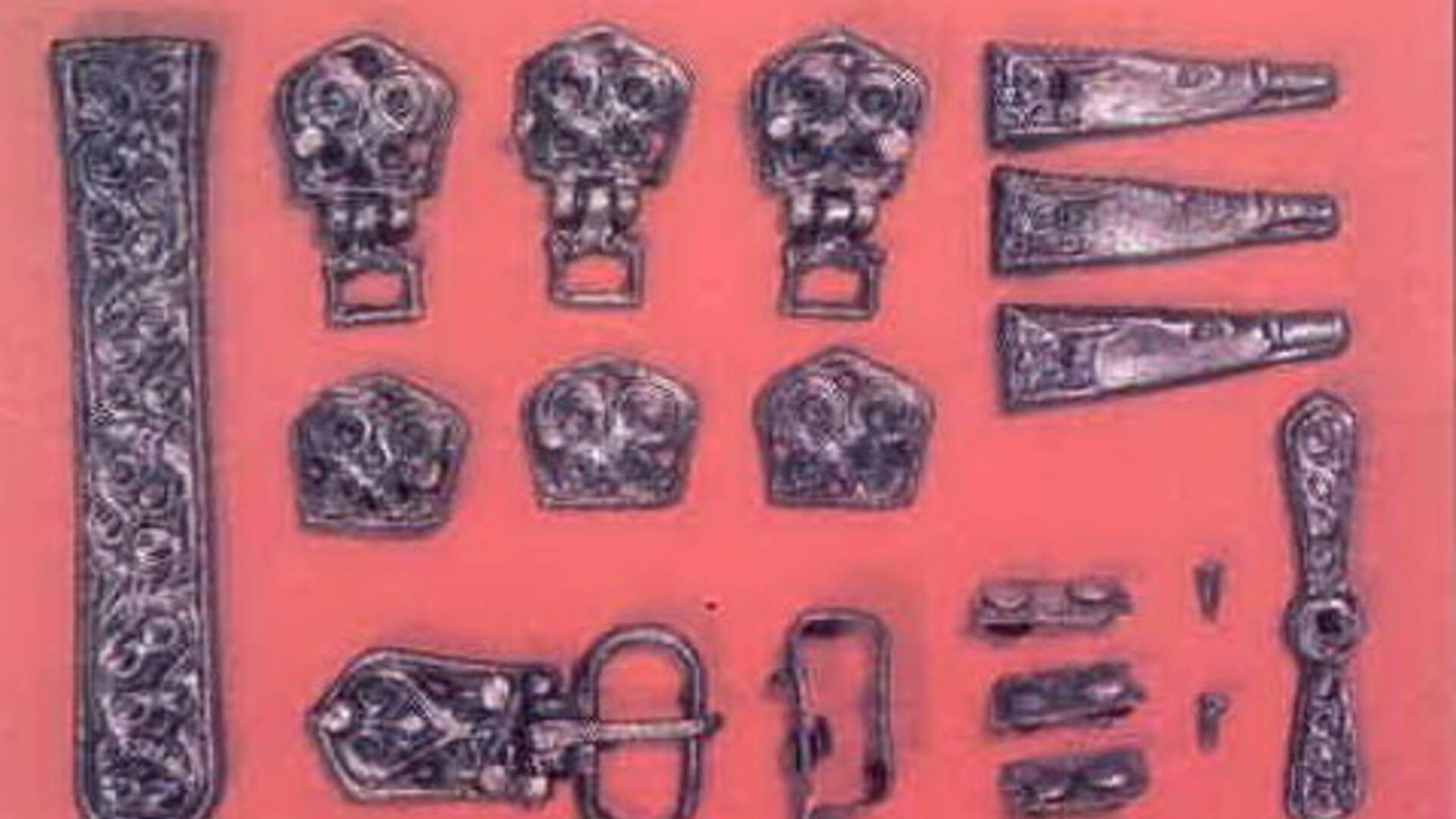
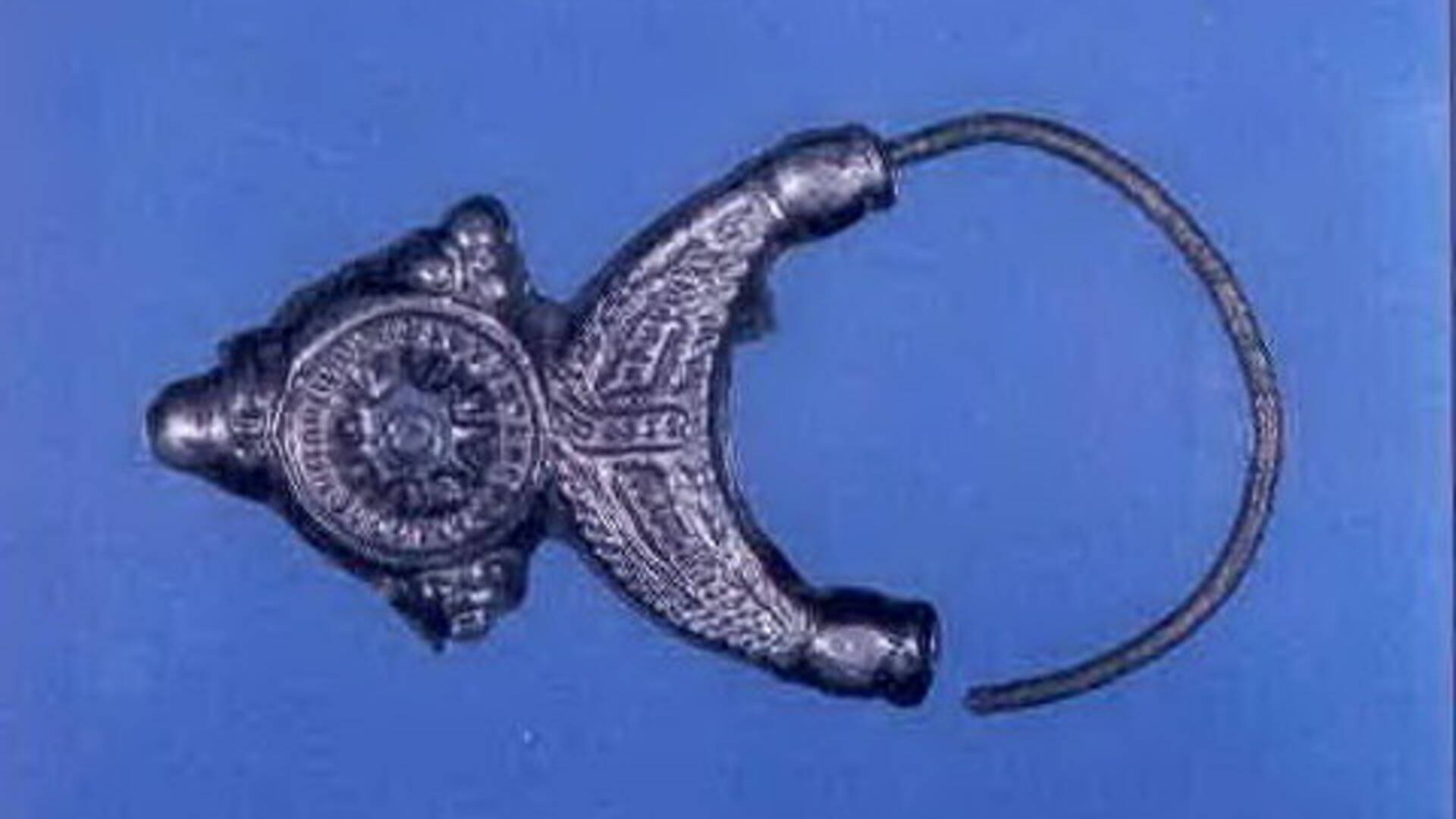
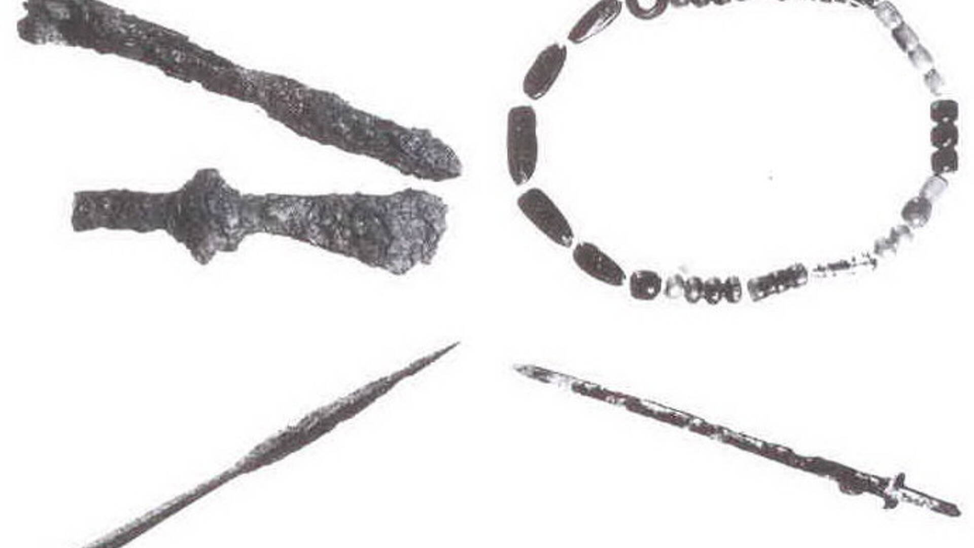
In a very busy and rather unclear period of migration, a new ethnic group began to come to our regions and gradually settle in these areas - the Slavs, which laid the foundations for the new organization of Europe. In the 7th - 8th century, a Slavic settlement was located in Čataj, important not only from the economic point of view, but also from the military point of view. Evidence of this is provided by an extensive burial ground. At that time, various alms and ornaments, weapons and utility items were placed in the graves. Evidence of this is hidden under every house and on every hummock. Remains of demolished old houses and remnants of tools can be found during various deeper earthworks.
In the 9th century, the first Slovak state unit was established and developed - the Pribin Principality. The construction of housing estates in the Vyše Kandy position is definitely being strengthened and expanded. The nature of the dwellings has not changed, only the production process has been improved.
After the end of the class struggles and the final averting of the Turkish danger, many villages, as well as Čataj, were abandoned or half-empty. At the beginning of the 18th century, however, the economy began to recover. The village of Čataj was owned by the landowner Ján Pálffy at that time.

 Slovak
 Czech
Czech
 Hungarian
 German

