History
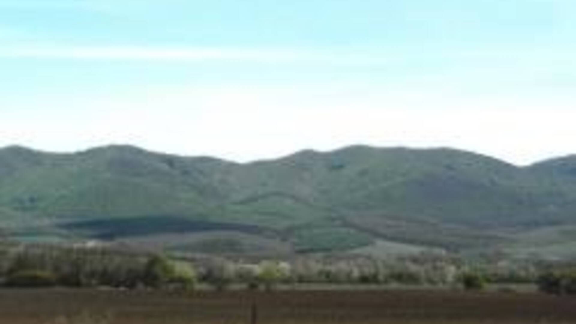
In the picturesque valley, which is bordered on the north by the Krupina Highlands, on the south by the Börzsöny Mountains, on both sides of the river Ipeľ lies the town. At this point, the valley is the narrowest: the distance between the two mountains is less than 3 kilometers. In the middle of this valley flows Ipeľ. The rich growth growing on the banks and the proximity of forests provided ideal conditions for the settlement of prehistoric man. Archaeological excavations testify that even in the Late Stone Age (Early Palaeotic) man lived here / 1 /, from the Krupinica stream to Parasso - today's customs area of the Slovak-Hungarian border.
The climate here is dry and warm, characterized by relatively short winters and long, above-average warm summers. The number of summer days (tmax at 25´C) is over 70, the average annual temperature is 9.5´C. The average precipitation for the growing season shows a deficit, which means that the evaporation is greater than the total precipitation. Fluctuations in precipitation are caused by the fluctuations of the Ipľa flow water. In the summer months, when moisture is most needed, it reaches barely 20m3 / sec, while in March it reaches up to 58m3 / sec.
Geologically, the river valley originated in the Neogene, when the still continuous Börzsöny and Krupinská mountains parted as a result of strong rock movement, and the sea penetrated here as the valley fell. Later, with the decline of the sea, the entire Danubian lowland also decreased, which had an impact on the occurrence of large erosion in the Poiplí, which created river terraces. These are well visible on the Calvary Hill and on the conglomerate terraces behind the cemetery. In the Miocene, volcanic activity took place in our area, the epicenter of which was probably in the Krupina Highlands. Our vineyards "Nagyszőlők" are also of volcanic origin, where quality wine is born. Near the town, the flow of the river slows down considerably and, due to the shallowness of the banks, it exits the riverbed several times a year. Here, solid parts of the earth's crust, washed away by erosive activity from the upper reaches, settle. The thickness of the sediment thus formed also reaches 4-7 m. Different types of sedimentary soils were formed on them.
The first written mention of the existence of the Saag settlement is from 1237 in the document of Bela IV., Written in Zvolen. In it, the Esztergom church, owned by two and a half plowed lands and one mill in the Saag district, belonging to the Hont castle, confirms. The second document from 1256 describes the settlements adjacent to the Shahs: the village of Olvár, the village of Tešmak, the village of Proma and Sági-sidó (on the site of today's Kómájszőlő). At that time, according to the mentioned document, Peter Viski, Rugas' son Egyed, as well as castle subjects and royal servants, royal courtmen, the Esztergom chapter and the Shah's post office were also the owners of land in the Shah.
From the point of view of the development of our city, the decisive event was the establishment of a monastery in Šahy. The documents did not tell us anything about the exact date of its creation. According to Fuschoffer's Monasteriology, the Hunt family founded a Benedictine monastery here in 1705, but the latest research shows the years 1236-1240. However, it is certain that the founder was Ban Martin, who had no descendants, with the consent of Bel IV. he donated his property to the monastery. Márton also chose the place for the construction of the monastery very well: in these places the main road crosses the river Ipeľ, which led from the mining towns towards Esztergom and Budín via Visegrád. His broad political outlook and selflessness confirms that he entrusted the monastery to an independent king and thus proved that he had in mind not family but state interests. This fact set the direction for the development of the Shah for several centuries to come.
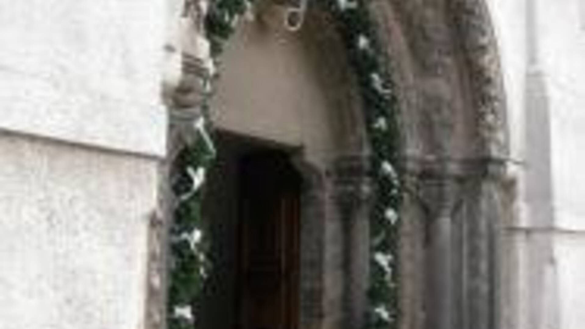
It is well known that the founder of our county, after whom she also called herself - Knight Hunt - built his fortified settlement in the present village of Hont, where the river Ipeľ created a peninsula protruding above the river, thus ensuring its sufficient protection. A monastery was built on the other side opposite the fort. The Premonstratensians were very popular because, in addition to the churches, they also performed secular services: they helped the poor and the sick, but especially because the postmaster named after the Blessed Virgin Mary (Prepositura B.Mariae de Saag) was also a credible place not only for Hont County but surrounding counties. It has been known since 1255. Unfortunately, the original stamp of the convention has not been preserved, but it is known from 1397.
Soon after its foundation, the monastery had to face various external dangers. The Tatar hordes probably reached Šahy around February 1242/3 / and the settlement and the monastery were completely burned and looted. A new charter was issued by Belo IV. September 9, 1245 in Hrhov. Because this charter was also an inventory of assets, the composition of the population at that time is known: three court robes, six horse riders, five servants, three winegrowers, two plowmen and several servants, according to their trades. After the Tartar devastation, the convention quickly recovered and gained the respect and trust of the surrounding population. During the 30 years of the monastery's existence, the turnover of goods through Ipeľ has increased to such an extent that the existing transport was no longer enough. Therefore in r. 1266 King Belo IV. he ordered the construction of a stone bridge on Ipli near the monastery and gave the right of toll to the Premonstratensian order.
In the period after 1270, after the death of Bela IV. there was a power struggle between the families of the high nobility. The family of Matúš Čák ruled in the northwest of the country, as well as in our country. Constant internal unrest and insecurity paralyzed the country's economic life and the people were ruled by poverty and hunger. In order for the monastery to be able to fulfill its secular tasks, in 1275 King Ladislav IV. relieves the people of Shiah from taxes and the obligation to house soldiers. At the end of XIII. century, the work of the monastery was supported by Stephen V by donating new property. This is how Tešmak got the previous settlement of the guardians of the royal forests, then Pečenice, Dolné Jabloňovce, Lipovec and Olvár. R.1299 "seven bishops and an archbishop allowed pilgrimages under certain conditions" and the resulting money to be used to build a new church.
The size and strength of the castle estates, the constant struggles between the nobles and the impoverishment of the population and the royal court itself led to the gradual disappearance of the royal counties and their replacement by noble counties, which provide a much broader framework for the country's common life. In our conditions, the role of Hontian Castle and its manor was taken over by Drégeľ Castle.
The Shahan monastery lived through its golden age from the beginning of the 14th century. century. At that time, for almost thirty years, it was headed by the postmaster Ferenc Fegyverneki, a high priest of the European format, a devoted follower of reformist ideas. Between its walls they raised priests, edited books and verified documents. In order to facilitate the writing of the letter, Fegyverneki compiled such form books, which unified "all the file formulas" with their register and clear content division in a clear form ". Together with other monks, he contributed to the enrichment of our codex literature / 4 /.
The kings of the Árpád family continued to fully support the monastery in its activities. Louis I, in 1357, with his privileged charter of the people, placed the post office under the general power of the post office. R.1405 King Sigismund allowed the Forum liberium (free market) every Sunday, and on the day of the Assumption of the Virgin Mary - on the feast day of the patron saint of the Shahan church - again a public market day. This right also applied to the property of the Convention. Soon, in 1470, the Shahs received the right of the sword from King Sigismund.
The powerful neighbors envied the rise of the Shahan Convent. Thus, in 1444, the four sons of Balázs of Ďarmôt expelled the postman Bálint and his companions from the monastery and turned the monastery itself into a fortress. Two years later, the sons of Duke Peter of Levice and their companions looted the monastery again. Therefore, King Ladislav I ordered an extensive investigation against them, but there are no reports of its outcome. However, the Shahan Convention still in 1511 led a dispute with the Levický family over the return of treasures and diplomas.
The favorable location of the Shahs resulted in their consistent connection to the medieval road network. The main road from Esztergom and Budín led along the hillsides along the river Ipeľ and its tributaries across the Šahanský bridge to the mining towns, especially to Banská Štiavnica. Vyškovce was also an important crossroads in the area, guarded by fortifications at that time. Here, the Esztergom road crossed with another road through the valley of the Búrský brook, and the two led together through Šahy. From there, the road led through Hokovce to Žemberovka and Bátovka (to the "Queen's Market"), and also through Nemce to Krupina and Banská Štiavnica. Another road led from Šiah next to Krupinice through Plášťovce to Litavský hrad and to Bzovík, where there was the second Premonstratensian monastery. The road to Hont and Drégelypalánk led east over the bridge to Ipli and another wooden bridge over Ipeľské Predmostie to Vinica or Balog nad Ipľom / 5 /.
After the fall of Budín, Vácov and Esztergom, Turkish troops advanced further towards the mining towns. Therefore, in 1546, the Viennese government determined by Regulation No. 44 the "strengthening of the Shahan monastery into a castle at state expense" / 6 /. The first captain of the castle was Juraj Thury, who already in 1544 distinguished himself with a heroic attack on the looting Turks, returning to Esztergom after the unsuccessful conquest of the castle in Levice. He caught up with them at Salk and properly dusted them off. Since In 1550, František Jakisich became captain in Šahy. At that time, the Turks tried to conquer the Shah's fortress, but their attack was repulsed. The year 1552 became fatal for the monastery castle. Although the Drégely castle was heroically defended by Juraj Szondi, he succumbed to a great advantage on July 4 and fell in battle himself. A few days later, the fortress in the Shahs fell, and although the Turks looted and burned everything, the Order's brothers saved their precious archives by transferring them to the St. Benedictian monastery, where they took refuge.
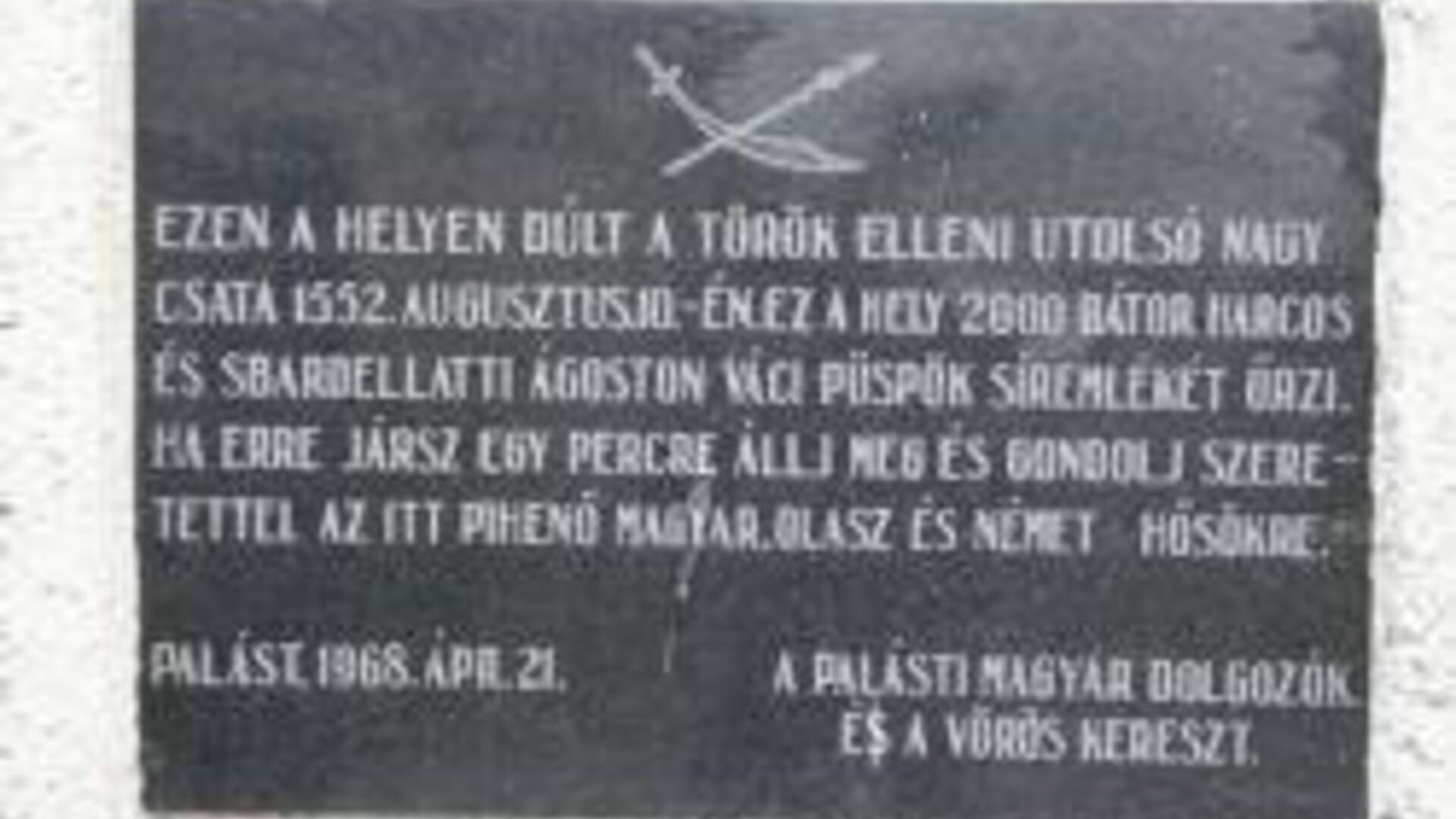
The Shah's archive of the credible site was later transferred to Győrszentmárton (today's Pannonhalma). After the conquest of Shiah, Turkish troops numbering 12,000 men under the leadership of Ali Pasha continued towards the mining towns. At that time, the Vienna court also recovered and wanted to prevent them from moving forward with a quick counterattack. The proud general Erasmus Teuffel was entrusted with the command of the imperial troops. He received the commission from Emperor Ferdinand I. Due to his bad nature, the Hungarians called him Ördög Mátyás, or Matej Čert (Teuffel = Ördög = Čert - Nomen est omen). Tinódi Lantos Sebestény, a poet at the time - a fan of heroic battles, described the fight near Plášťovce in detail / 7 /. According to this, we know that the imperial troops had 10,000 soldiers. They did not wait for the reinforcement that was to come from Fiľakovo Castle, but with the army that camped near Hrkovce, they fought against the Turks. They met in the narrow valley of Krupinice near Plášťovce. Teuffel did not prove to be a duke here, so he was defeated after a two-day battle. Bishop Sbardellatti of Václav, head of the supply department, also died in the fighting. He fell on the way from Šiah to Plášťovce, where a small chapel was built in his memory. After this decisive battle, the Turks occupied up to 9/10 of the territory of Hont County and only the northernmost part in the vicinity of Banská Štiavnica was not conquered. The Turks controlled the Shahs twice. First in 1552-1595, then from 1663 until the liberation of Buda / 8 /. After defining the boundaries r. In 1595 the Turkish-Imperial border was between Tešmak and Šahy on Silberské lúky. A deep jarok, called the "Turkish jarok", was dug to mark the borders. However, the Turks also abused it several times, crossing it during looting. They also threatened mining towns (Pukanec, Krupina, Banská Štiavnica) several times, but did not conquer them. During the Turkish occupation, they built a strong Palanka castle under Drégely Castle - made of piles, slabs and a fortress and wooden bridge over Ipeľ, from where they led unexpected attacks on the surroundings. They also served to defend the castle itself. According to the property inventory in 1626 kept by the Turkish pašalík, we know that there was only one port in the Shah, as well as 16 farms with 1/4 land, who had a total of 8 horses and 40 oxen. After the census by taxpayers, 33 families were described.
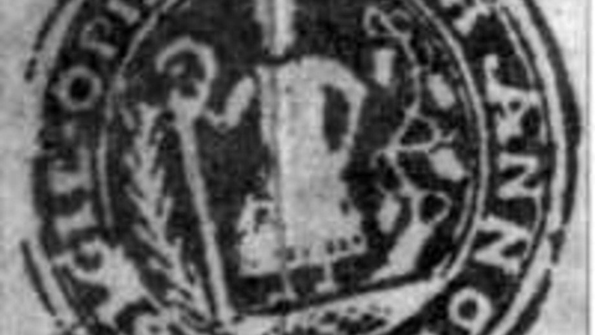
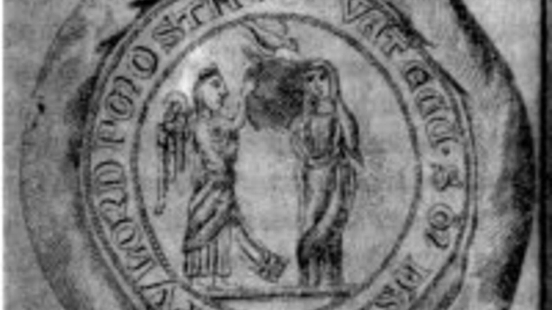
The first city seal that has been preserved dates from 1665. It depicts a post office with a miter and a bishop's crutch with a round inscription "Sigillum oppidi Saag", ie: the seal of the city of Saag.
Accordingly, in those years the Shahs had an urban character. The register began to be written in 1675, but due to frequent fires, old documents were destroyed. Even during the Turkish enslavement, the people bore the greatest burden on their shoulders. Frequent robberies, frequent double taxation, perpetual hiding and malnutrition cost many victims. Infectious diseases have also become widespread. The first contagious plague broke out in the city in 1600 and was repeated in 1623. In 1663 it was so terrible that 40% of the city's population fell victim / 10 /.

 Slovak
 Czech
Czech
 Hungarian
 German

