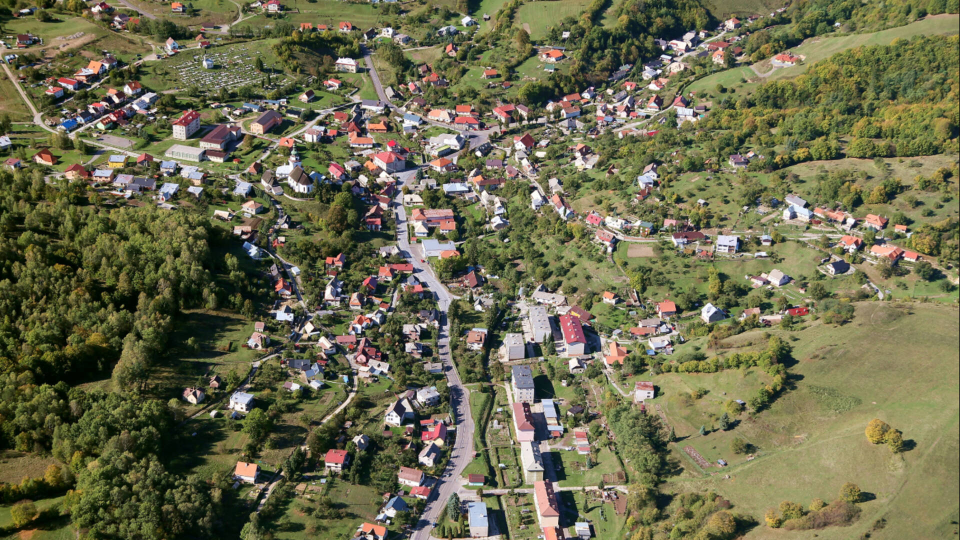
The village stretches 5 km northeast of Banská Štiavnica, in a valley along the main road leading from Banská Štiavnica through Banská Belá towards Kozelník and Hronská Breznica. It borders the village of Podhorie in the north, the village of Kozelník in the northeast and the village of Banský Studenec in the southeast. Banská Belá is the largest municipality in the district, the cadastre has an area of 2086 hectares. The center of the village lies at an altitude of 475 m above sea level, the area at an altitude of 370 to 840 m above sea level. The village has about 1230 inhabitants.
The area of the village is mostly mountainous, in the western and southern part deforested, in the east and north forested with deciduous and coniferous stands.
The state road of the 1st class (1/51) leads through Banská Belá from Banská Štiavnica towards Hronská Breznica, which feeds into the road Žiar nad Hronom - Zvolen. The railway connection is normally the Hronská Dúbrava - Banská Štiavnica gauge line, called the Youth Line, which after the start of operation in 1949 replaced the original narrow-gauge railway, built in 1873. From Hronská Dúbrava there are connections to Zvolen, Vrútky and Bratislava. There is also a bus connection from the village, a suburban bus line Banská Belá - Banská Štiavnica and intercity lines Banská Štiavnica - Zvolen - Banská Bystrica. From Banská Štiavnica there are connections to other intercity and long-distance connections.
Starý potok (Beliansky potok) flows through the village, from the road junction near Jergyštôlna. It is fed mainly by mining waters from the abandoned hereditary Ferdinand tunnel and only partially by a waste stream from Lake Belianske and surface waters during rains and snowmelt. In the middle of the village, the Solisko stream from part of the village of Pivár joins it. At the former Dinas plant, it flows into the Jasenica stream.
The system of Štiavnica lakes - tajchov, which were built in the 18th century for mining purposes, also includes two lakes near Banská Belá, namely Halčianske lakes (tajch), named after the valley and the settlement of Halča, belonging to Banská Belá, and a waterworks. Jasenica in the part of the cadastre in the direction of Kysyhýbel. Lake Belianske, which lies in the valley on the left below the main road leading from Banská Belá to Banská Štiavnica, is already cadastral to Banská Štiavnica. The lakes belonged to Geramba's mining union and built them as reservoirs to drive the stupas that were built along the Old Creek and the Jasenice Creek.

 Slovak
 Czech
Czech
 Hungarian
 German