It is the first and only place in Slovakia where you can meet the so-called A sandy landscape model with augmented reality (Eng. Augmented Reality Sandbox), which is experiential educational tool, using the latest digital technology. Slovakia was the only state of the Visegrad Four and one of the last in Europe that did not have this modern teaching technology on its territory.
Despite its small physical dimensions, the Slovak Map Museum is an institution of supraregional significance, a popularization-educational and cultural-technical attraction , unique not only on a Slovak scale, but also in the whole area of Central Europe. It is a way that we want to contribute to the development of Slovak society and help it continue to grow.

Who is the operator of the museum?
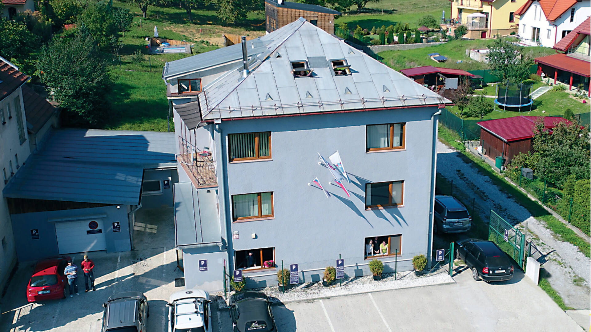
The operator of the Slovak Map Museum is the company CBS spol, sro It belongs to the consortium of CBS companies, which operate in two countries and consists of four companies.
The CBS story itself began in 2003. It currently employs more than 90 people. The consortium of companies is constantly growing and the next plan is to get some of our original products, especially hand-painted maps , abroad as well. Today, thanks to CBS activities, Slovakia and the Czech Republic are the countries with the largest number of painted maps in the world. Some firsts were also attributed to the Slovak and Czech books of records. Thanks to CBS, Slovakia is also the only country in the world that has its own comprehensive edition of aerial photography books from each region. The Czech Republic will follow him.
In 2016, more precisely on October 26, 2016, CBS bought the cartographic part of VKÚ, as and returned the popular VKÚ brand on map products back to the market. We can consider this date as the beginning of a new life of the legendary tourist maps of VKÚ Harmanec, which followed the CBS's cartographic activities of the state Military Cartographic Institute.
The Military Cartographic Institute in Harmance started its activities in 1948 and today this brand has been a respectable 70 years.
With this step, we also hand-painted maps that were among our key products, launched the production of one of the best tourist maps of Europe.
Why did we create the Slovak Map Museum for you? What was our motivation?
CBS's connection with maps has been closely linked since the beginning of its activities. The owner of the company himself, as a big fan of maps, had his dream, his idea of popularizing mapping, cartography and maps as such. In today's digital age, the role and use of maps is more in the form of mobile devices, the Internet or mobile applications. And what was the development of mapping from historical times to the present day, you can see in the Slovak Museum of Maps.
Here we come to our motivation, our main goal, to create a popularization-educational place , where we want to introduce this topic to you in an experiential form. We have decided to present everything we know about the production of maps to the general public.
Come and have fun, maybe learn something, but above all learn something about maps.

What awaits you?
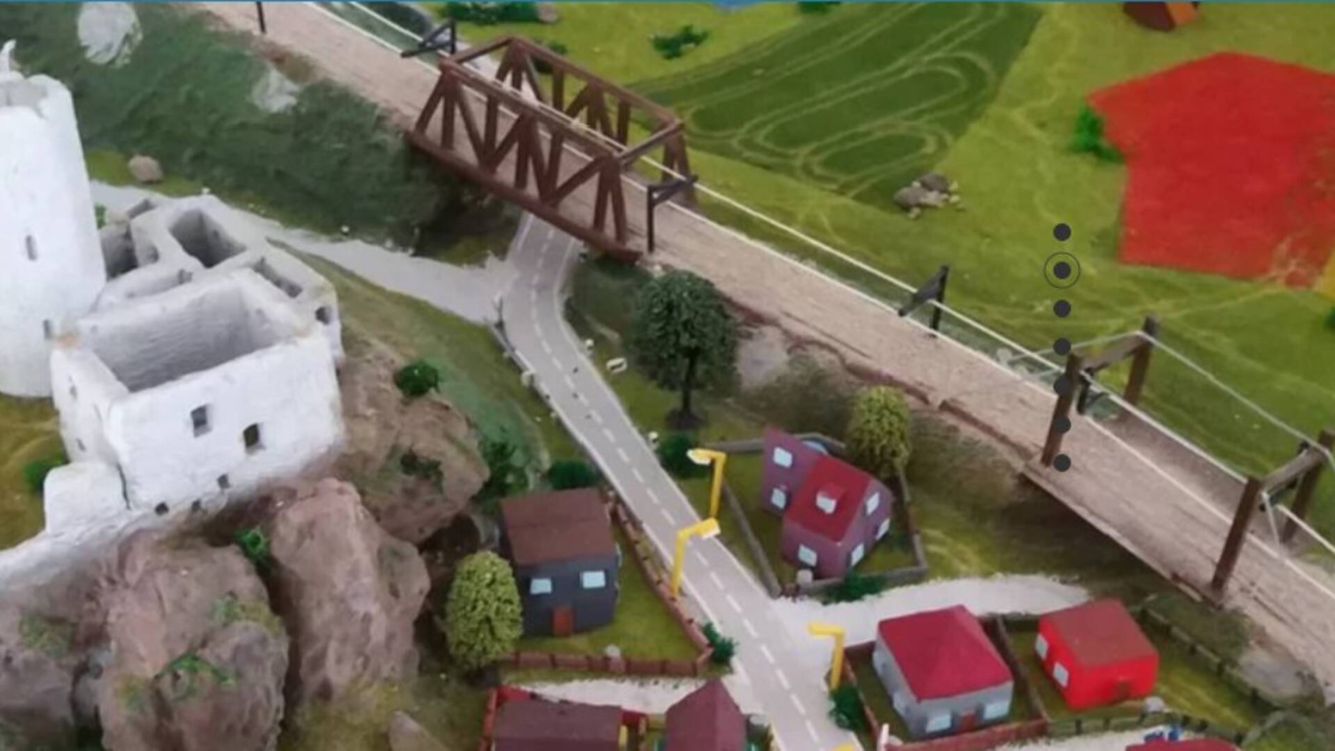
Augmented reality landscape model
It is not a sandbox like a sandbox. You will fall in love with this at first sight. Build the landscape with your own hands, create mountains and valleys and instantly remodel it into a plain, or turn the valley into a river bed. There are no limits to imagination! Do you know what contours, depths and hypsometry are? If not, you will fully understand this on this model.
Fun cartography
Together we will look at the country we have created for you especially for mapping. To find out how the whole journey of the map begins, we will show you step by step. You will playfully create a map of our model country in your own way. And in a manual way, as it was done in the past, and in the computer, as it is done today.
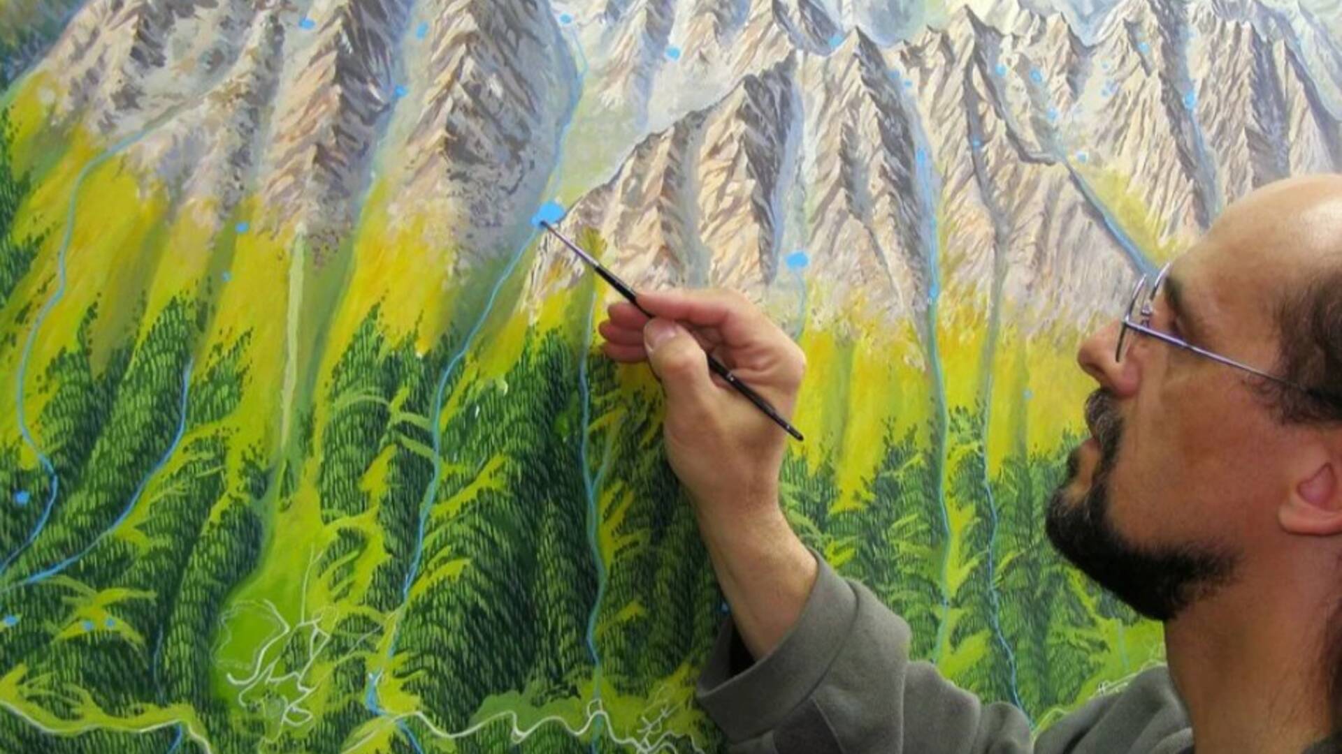
How is a painted map created?
A painted map is a special work of art. The painter manually draws every object, every path, every hill and, in fact, everything in the country. The landscape is captured in a perspective that is easy to read even by a person who cannot read a normal map. You will learn how the painter proceeds and what are the individual stages of production of a painted map.

A little history
What would a museum be like without the history of cartography and old maps? We will look at the development of maps in the world, but of course also in Slovakia. You will also find some truly unique maps here.
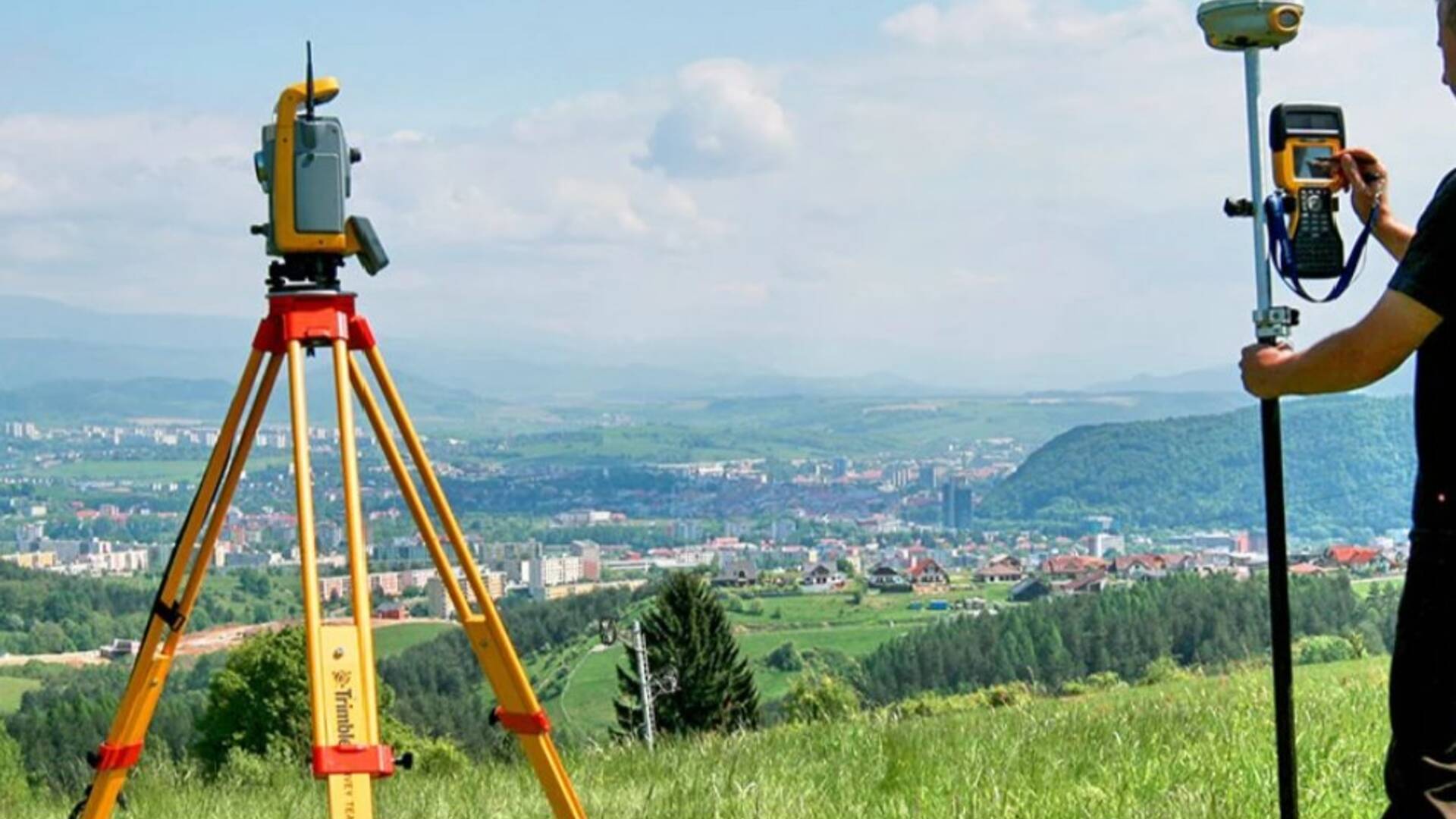
What is geodesy and what does a surveyor do?
Surely you've seen a surveyor looking at a strange device on a tripod somewhere in the field, or standing with a special pole in a field. A surveyor is a surveyor, a person who measures the earth, and in our museum you will understand how important his work is for the creation of a map.

Is the Globe really a sphere?
Want to know the answer to this question? Do you know what really are the great states that are on the globe from the equator onwards to the poles? You will find out everything, we will explain everything to you.
Organizational instructions:
It is possible to enter the Slovak Map Museum accompanied by a lecturer.
Tickets are sold at the museum's box office / shop.
Parking for visitors is at the museum building and is free. Parking is for cars only. Buses can be parked in the nearby village of Nemce.
Entrance to the museum can be purchased during the entire opening hours of the box office.
The museum exposition is open every working day from 08:00 to 16:00.
Entrances to the museum are every hour (08:00, 09:00, ...), the last entrance to the museum is at 15:00.
The tour of the museum lasts 45 minutes .
The optimal number of visitors per entry is 15.
Entrance to the museum must be reserved in advance.
The founder of the Slovak Map Museum is CBS spol, sro and not the Ministry of Culture of the Slovak Republic, on the basis of which the Slovak Map Museum does not fall under the project of the Ministry of Culture of the Slovak Republic to open cultural institutions every first Sunday of the month.

 Slovak
 Czech
Czech
 Hungarian
 German