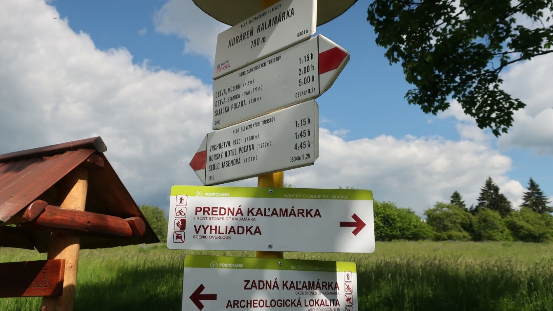
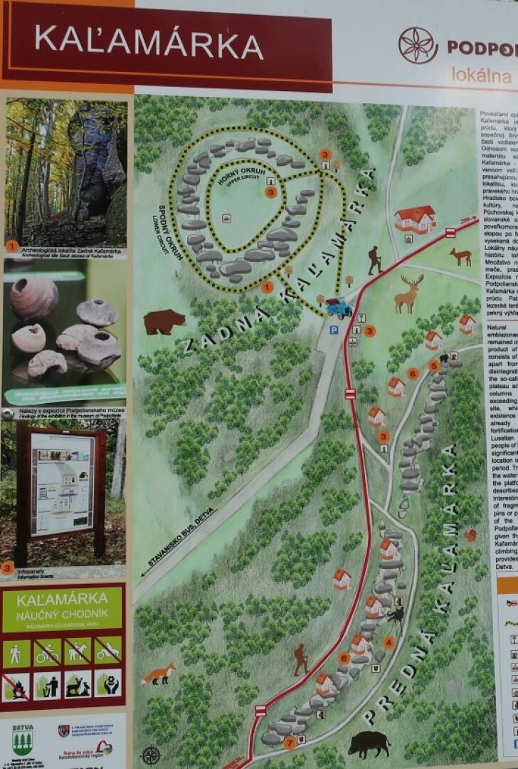
At the starting point of the educational trail, next to the tourist signpost with the red sign near the Kalamárka mine, there is a panel "Podpoľanie: Kalamárka: lokálna mapa / Local Map" with the marking of the trail's route. That's why we keep the shape of Kalamárka in the name of the trail, although the name Kalamárka is given differently (for a hill or a protected area). Focus of the trail: natural history, archeology. Trail type: self-service, circular, two-way, pedestrian, year-round Continuity with the tourist sign: A red tourist sign passes near the trail.
At the starting point of the educational trail, next to the tourist signpost with the red sign near the Kalamárka mine, there is a panel "Podpoľanie: Kalamárka: lokálna mapa / Local Map" with the marking of the trail's route. That's why we keep the shape of Kalamárka in the name of the trail, although the name Kalamárka is given differently (for a hill or a protected area). Focus of the trail: natural history, archeology. Trail type: self-service, circular, two-way, pedestrian, year-round Continuity with the tourist sign: A red tourist sign passes near the trail.

 Slovak
 Czech
Czech
 Hungarian
 German