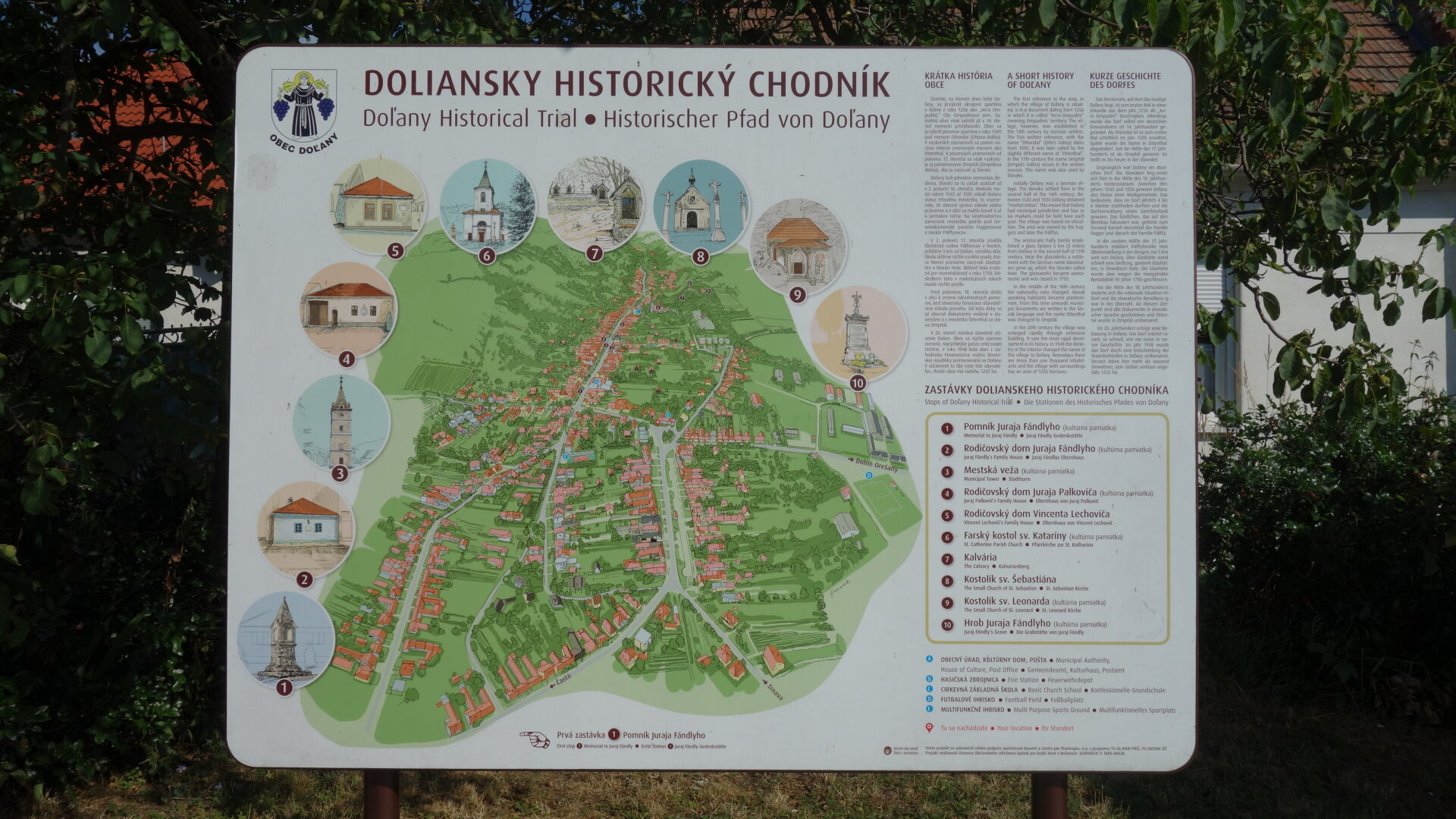
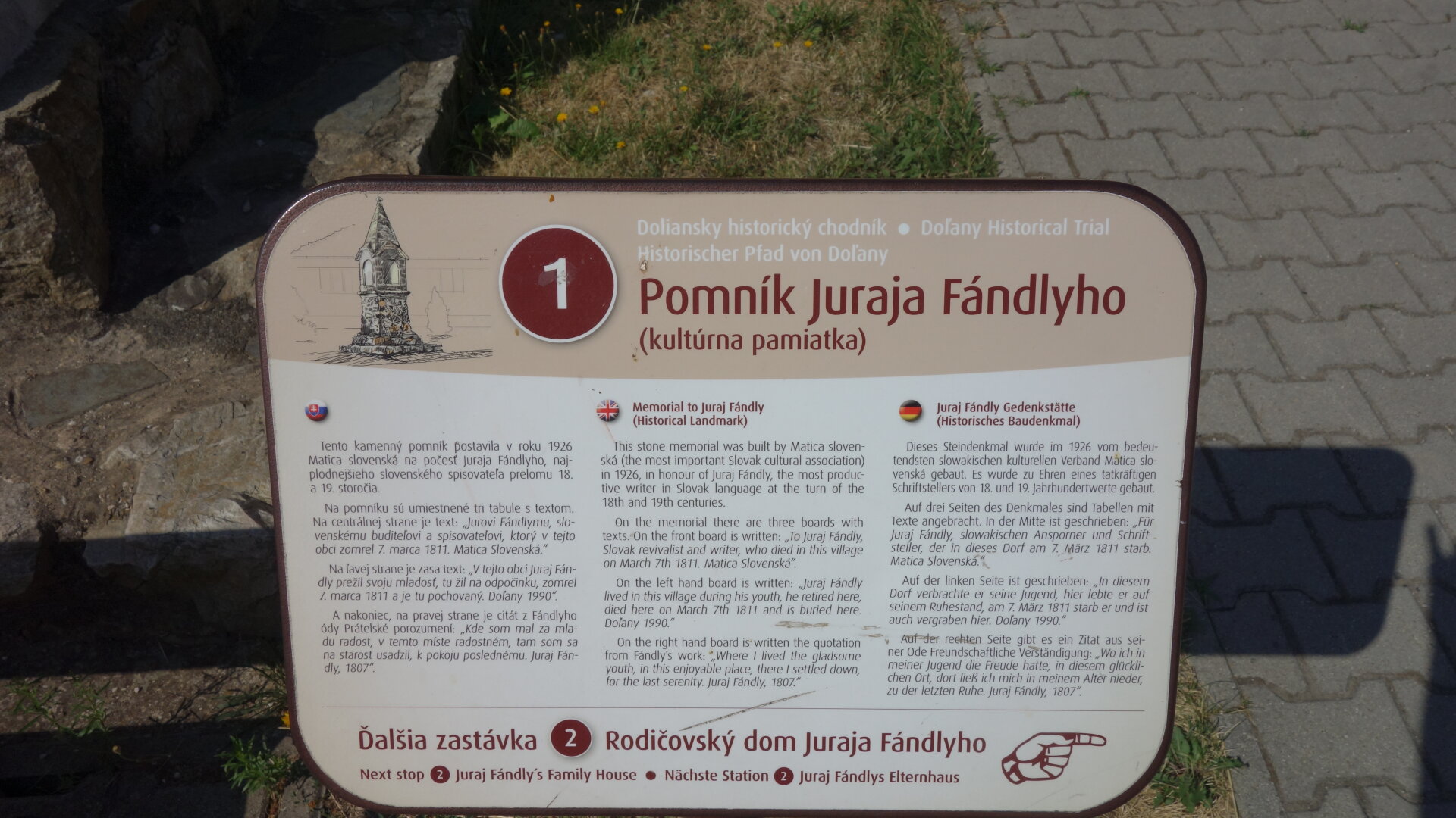
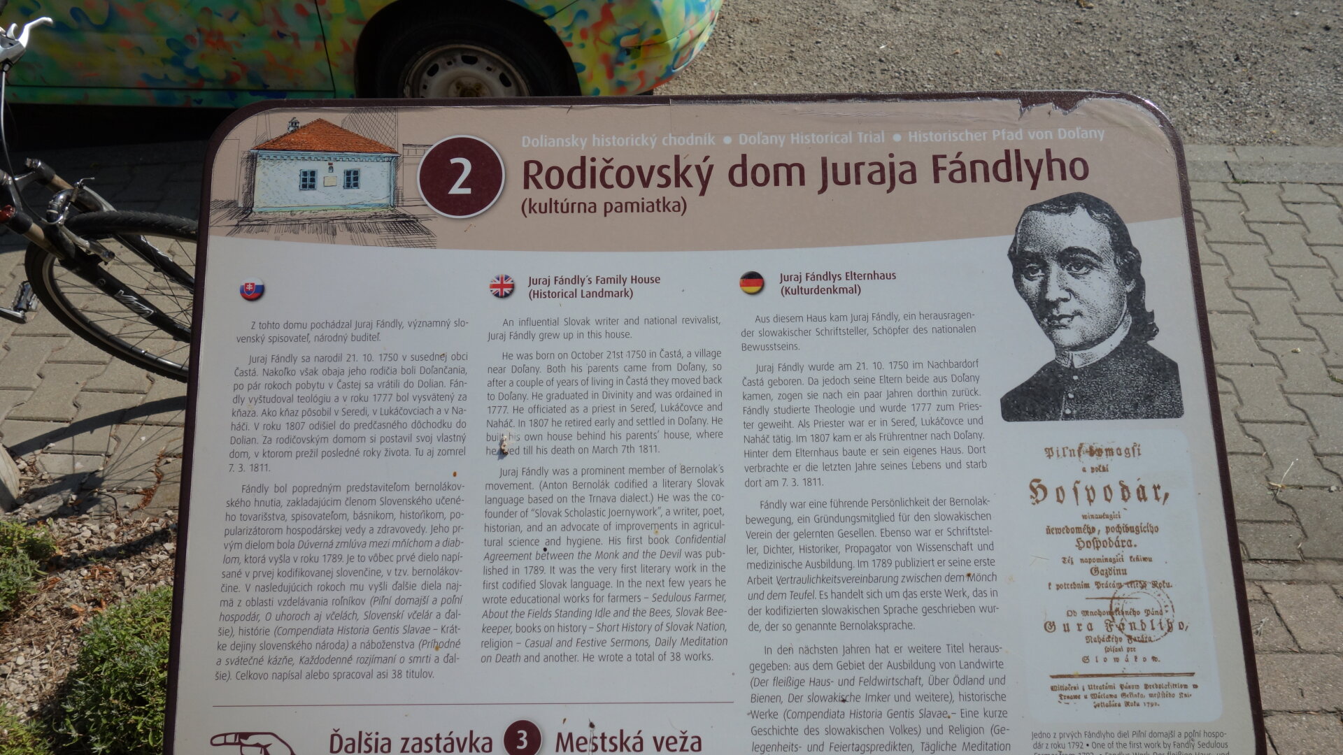
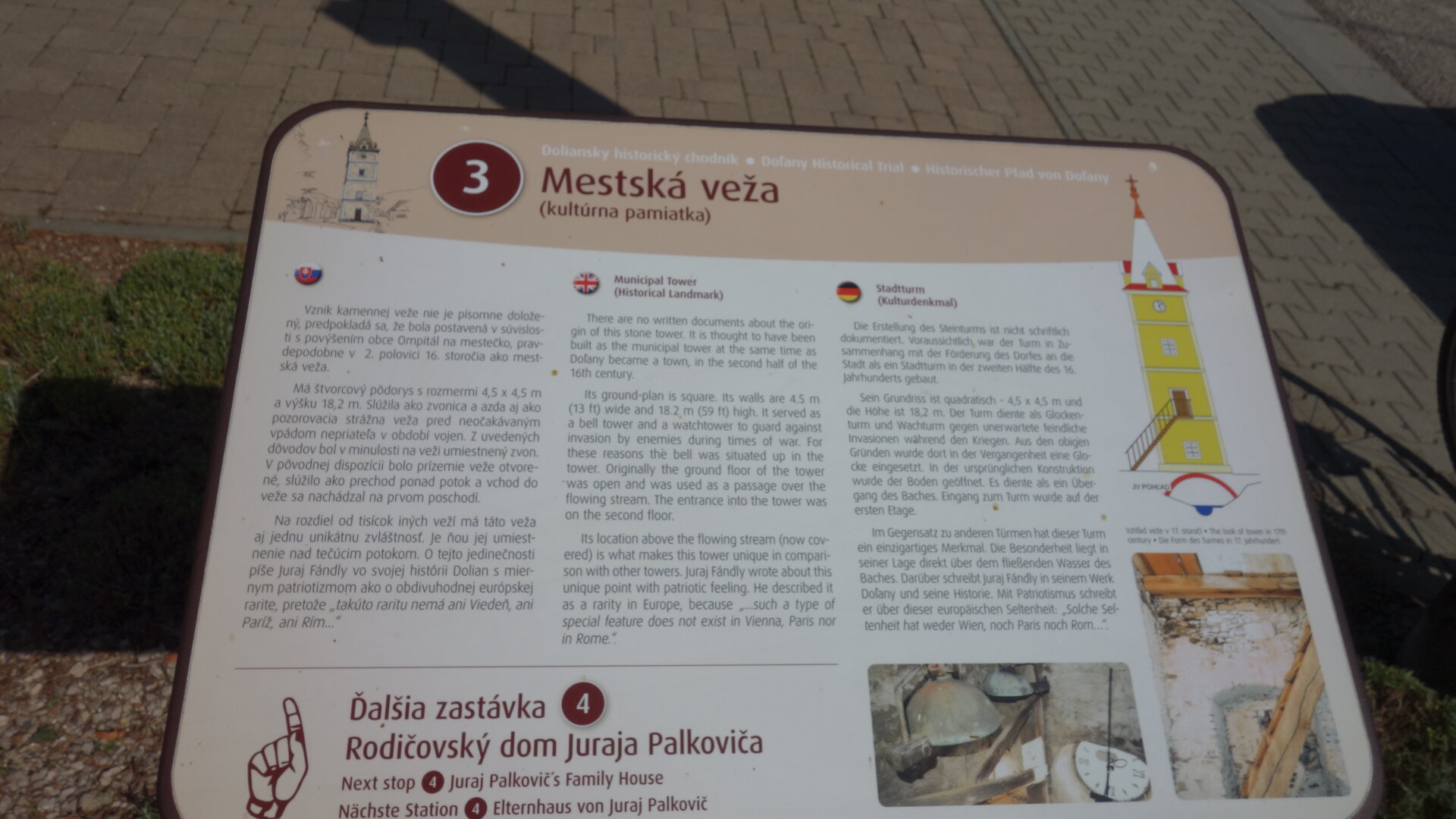
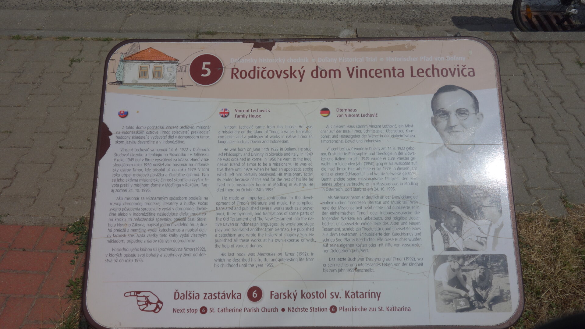
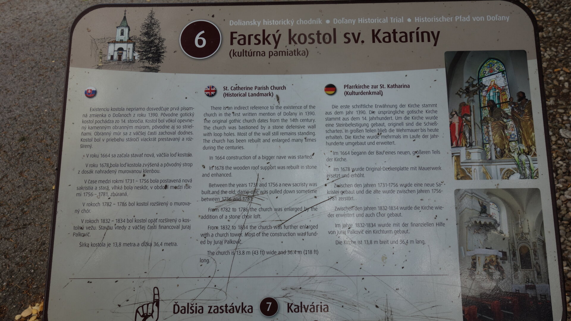
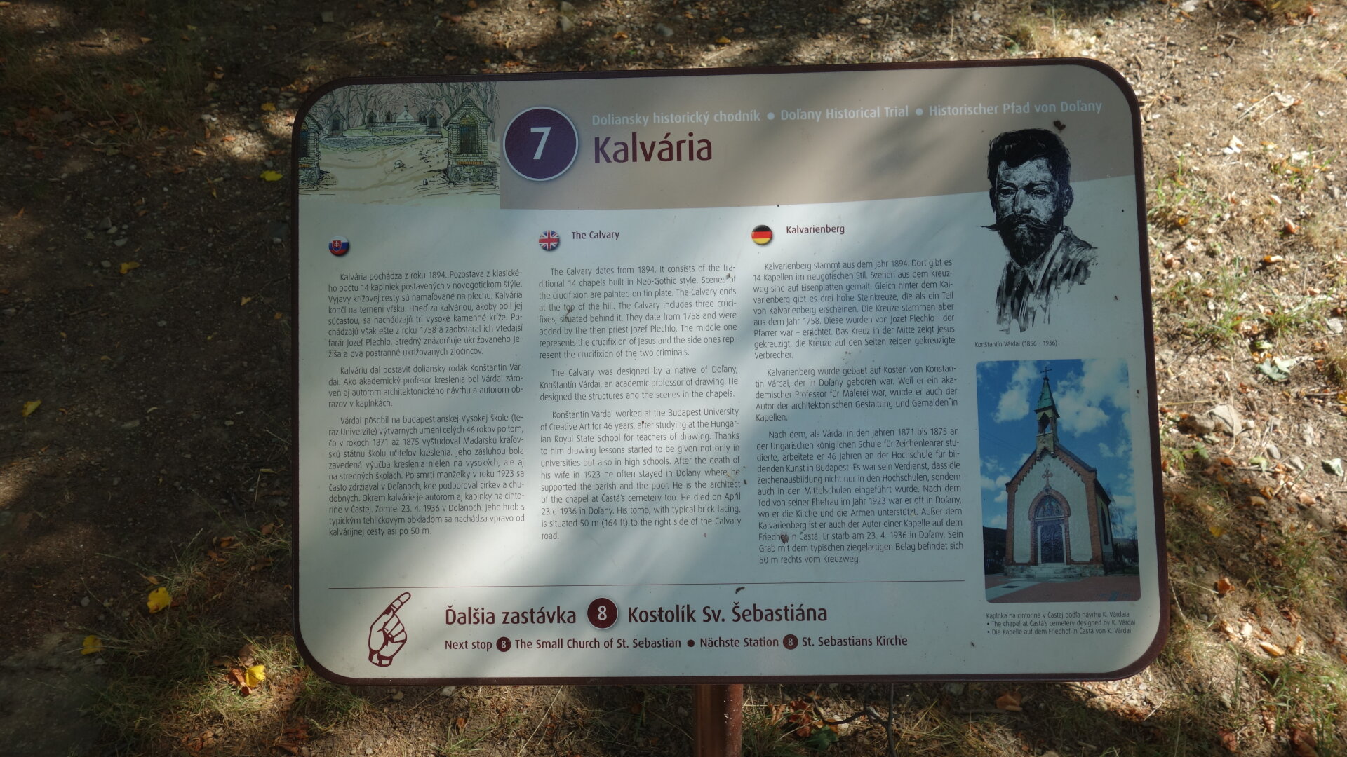
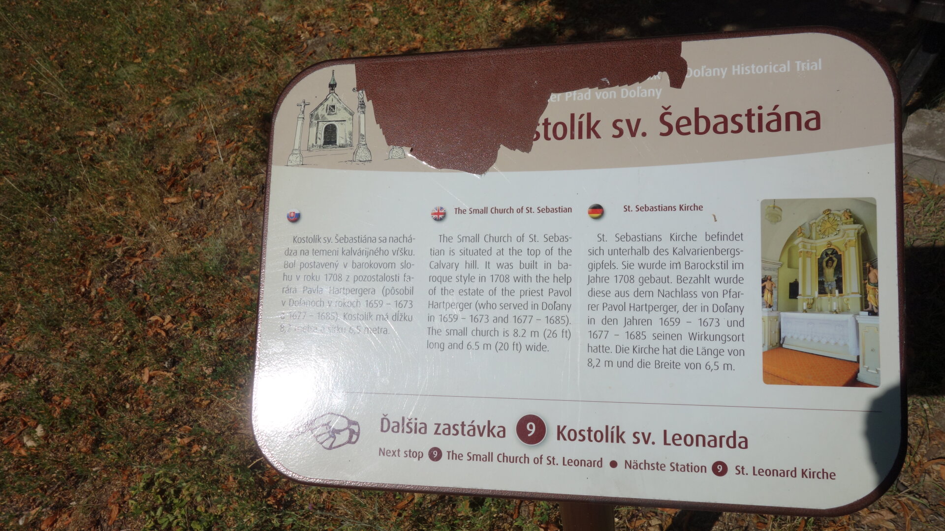
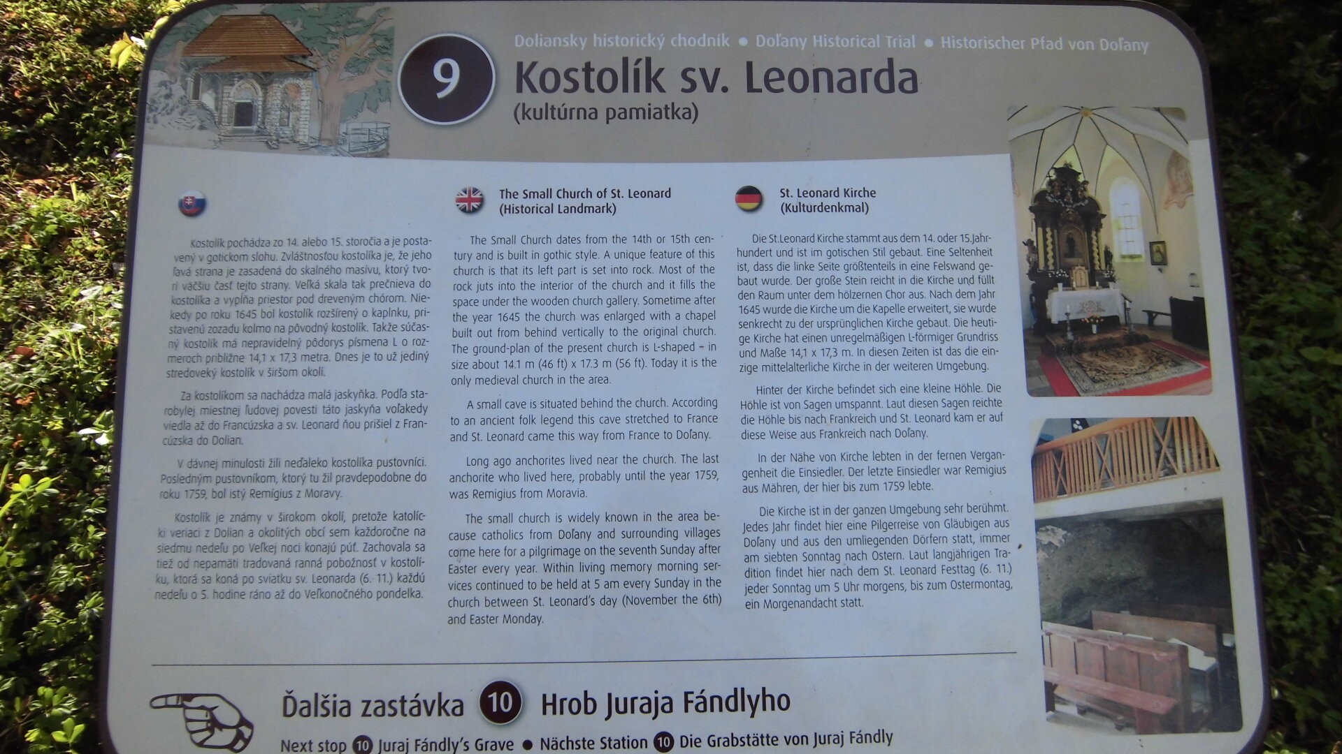
In August 2013, we implemented our most demanding project so far - Doliansky historický chodník. The main sign of the sidewalk is located at the bus stop. It has a brief history of the village and a hand-painted map of the village. The numbers in the circle indicate the individual stops whose name is multilingual. The texts on the individual information boards are in Slovak, English and German. There is an arrow to each additional board that indicates the direction of the sidewalk.
In August 2013, we implemented our most demanding project so far - Doliansky historický chodník. The main sign of the sidewalk is located at the bus stop. It has a brief history of the village and a hand-painted map of the village. The numbers in the circle indicate the individual stops whose name is multilingual. The texts on the individual information boards are in Slovak, English and German. There is an arrow to each additional board that indicates the direction of the sidewalk.

 Slovak
 Czech
Czech
 Hungarian
 German