CYCLING ROUTE AS A MEANS OF DISCOVERING THE NATURAL AND CULTURAL HERITAGE IN THE WHITE CARPATIES
304021X151
"Together without borders"
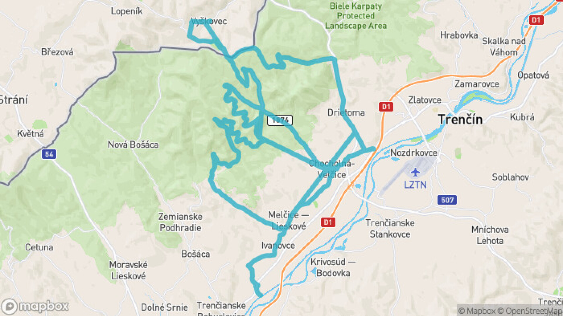
The main goal of the project is the connection of the Vážská cycle highway with the Beskydy-Carpathian highway and with the Naprieč Považské Inovec cycle highway through the construction and marking of cycle routes through the protected landscape area of the White Carpathians. By fulfilling the main goal, contacts will be strengthened and permanent cross-border ties will be created leading to the cooperation of residents, local governments and local entities in the field of tourism focused on the presentation of natural and cultural heritage. The connection point will pass through the territory of the Bielokarpatsko-Trenčia microregion through the Kykula border hill to the Moravian village of Vyškovec.
The result of the implementation of the project will be the construction of a cycle path with a length of 1.3117 km, a recreation zone in the village of Ivanovce, the construction of 10 gazebos and the development of a mobile application for better orientation in the region.
Total amount of authorized project expenses: EUR 304,221.84
Requested amount of non-refundable financial contribution: EUR 281,893.35
Total budget of the lead partner: EUR 161,873.84
Requested amount of ERDF contribution: EUR 137,592.76
Amount of participation of the leading partner: EUR 8,093.70
Implementation period: 01.06.2021 – 31.08.2022
Length: 82.7 km
Designed for: MTB bikes
Color: Sightseeing track
Difficulty: Recreational track
This bike route is part of an event organized by an external partner. It does not have to have markings on it, but you can use the GoSlovakia mobile application to easily complete it.
Length: 82.7 km
Designed for: MTB bikes
Color: Sightseeing track
Difficulty: Recreational track
This bike route is part of an event organized by an external partner. It does not have to have markings on it, but you can use the GoSlovakia mobile application to easily complete it.

 Slovak
 Czech
Czech
 Hungarian
 German