Kráľova hoľa is a place about which many legends, rumors and Slovak songs and poems were created. It could also be said that Kráľova hoľa is one of Slovakia's national mountains. With its height of 1,946 meters above sea level, it dominates the eastern part of the Low Tatras and thus deservedly belongs to the group of the most visited hills of this location.
Kráľova hoľa is known for its unique beauty and variety of nature, and it hides its wealth in the form of caves under the earth's surface.
It got its name according to the legend from the Hungarian king Matej Korvín, who hunted in the local forests and had lunch at the very top of the King's stick on a flat stone called the King's table, and there was an inscription on it that can no longer be seen today.
Its peak provides a circular view of a large part of Slovakia. Kráľova hoľa is also the place where the largest Slovak rivers originate - Váh (Čierny Váh), Hron, Hornád and Hnilec.
Several marked hiking trails from the surrounding villages lead to the top. The easiest route leads from the village of Šumiac along a 6 km (2.5 hour) long green marked hiking trail or along an old asphalt road, which cyclists will certainly appreciate.
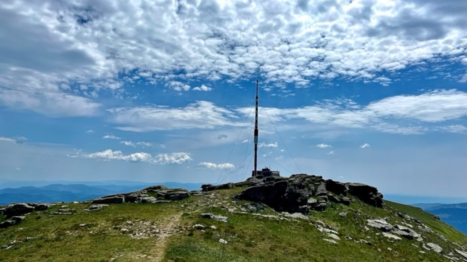
And for those who are more persistent and fit, Kráľova hoľa is an excellent starting point for tackling impressive ridge hikes in the Low Tatras. The transmitter provides an emergency shelter during inclement weather or an emergency sleepover. This is a tiny room, which is the only one accessible to the public, where a maximum of seven people can sleep comfortably on a mattress. The cycle path is currently being reconstructed. At the location of the transmitter, a facility for tourists, a buffet, or a shelter could be created, especially for enthusiasts of the popular path of the SNP heroes.
The broadcaster is a radio and television broadcaster in Slovakia.

 Slovak
 Czech
Czech
 Hungarian
 German